Heterogeneity on the Gila
Rivers are resilient. But they need space. (And water.)
For river ecosystems to survive dry times, they need their floods — and big, messy floodplains.
In a case study recently published in Hydrological Processes, co-authors Ellen Soles, Martha Cooper, and Laurel Saito demonstrate how channels formed during high flows on the Gila River connect native riparian vegetation to groundwater.
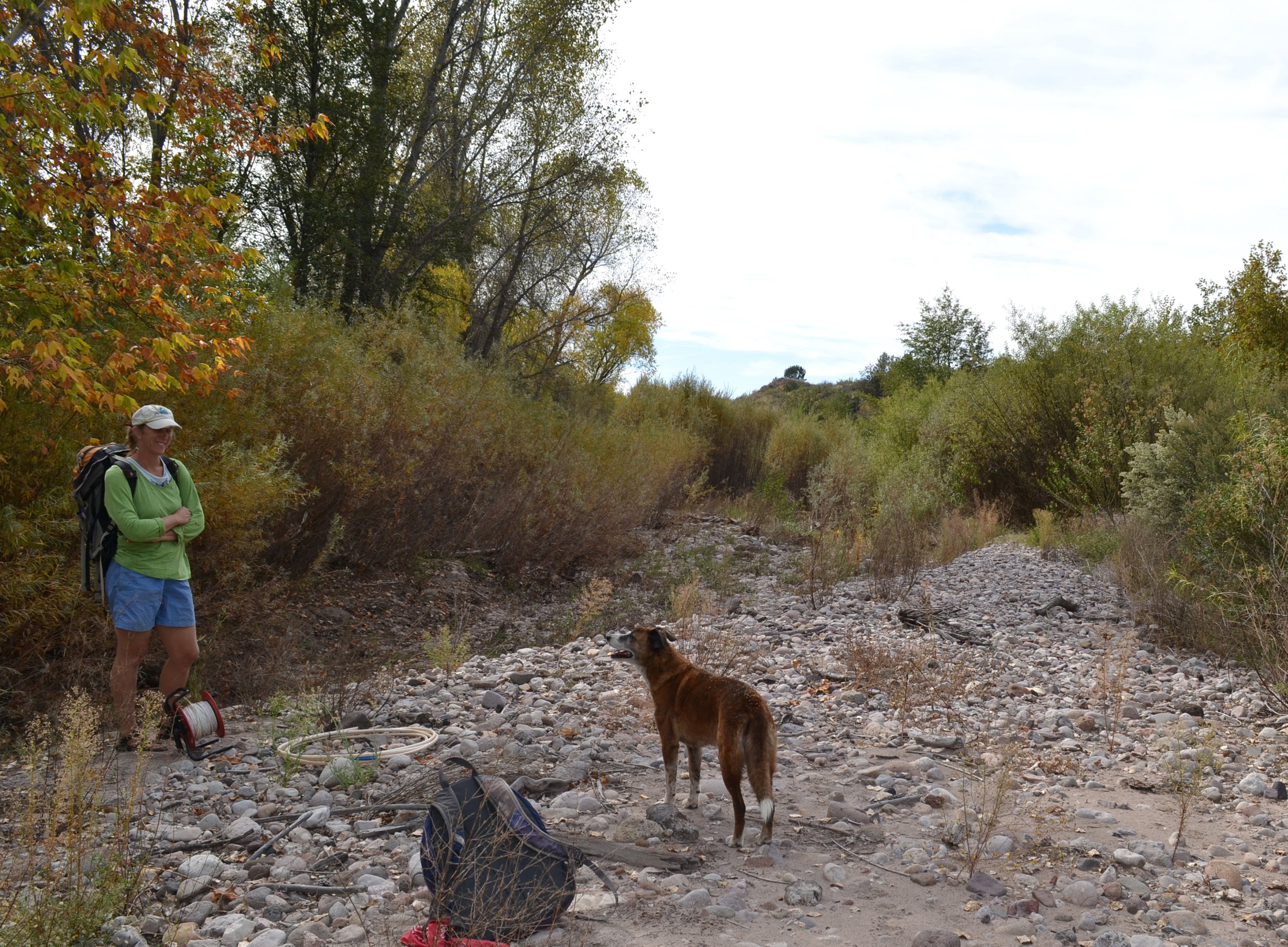
Currently The Nature Conservancy’s Freshwater Program Director for New Mexico, Cooper spent years living with her family at the Gila River Preserve and Lichty Ecological Research Center in the Cliff-Gila Valley, just downstream from where the river emerges from the Gila Wilderness.
“Science is an act of love,” Cooper says, recalling the years she and Soles spent thrashing across the river, transect by transect, measuring topography and vegetation changes, and learning about the riparian system’s complexity.
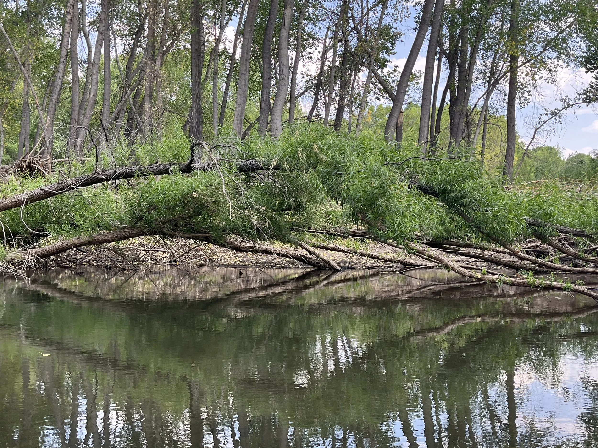
They also learned about the channels left behind when high flows roar and braid across the floodplain, then recede. These secondary channels allow native trees and plants to reach groundwater and spread, even when surface flows are low or nearly dry. “I didn’t ever think about groundwater until I moved to the Gila, and there was this moment,” says Cooper: “When the river was up — in pseudo-flood — and Ellen and I were walking down to a transect, my foot kind of broke through the soil and literally there was water rushing underneath my foot.” It was probably an old surface channel, sedimented over, and still alive underground.
“Science is an act of love.”
Martha Cooper, The Nature Conservancy’s Freshwater Program Director for New Mexico
Before generations of Anglo settlers wrestled the wild river into a smaller channel — planting fields, grazing livestock, and building irrigation infrastructure — the river in the Cliff-Gila Valley meandered, surging into new channels, creating swales, and blocking old passages. That messy floodplain is still visible in the wilderness and even toward the bottom of the Mogollon Box, where the Gila meets Mogollon Creek.
“The river used to come down and bend to the left and do a big, long meander,” Cooper says. “In one of our last big floods, a secondary channel cut off that meander and moved the river over. Now the river is straighter there, and it’s not great for boating, but the old channel is now the secondary channel.” Cottonwoods and willows are filling in and there are little wetlands, including old scour holes where groundwater is daylighted.
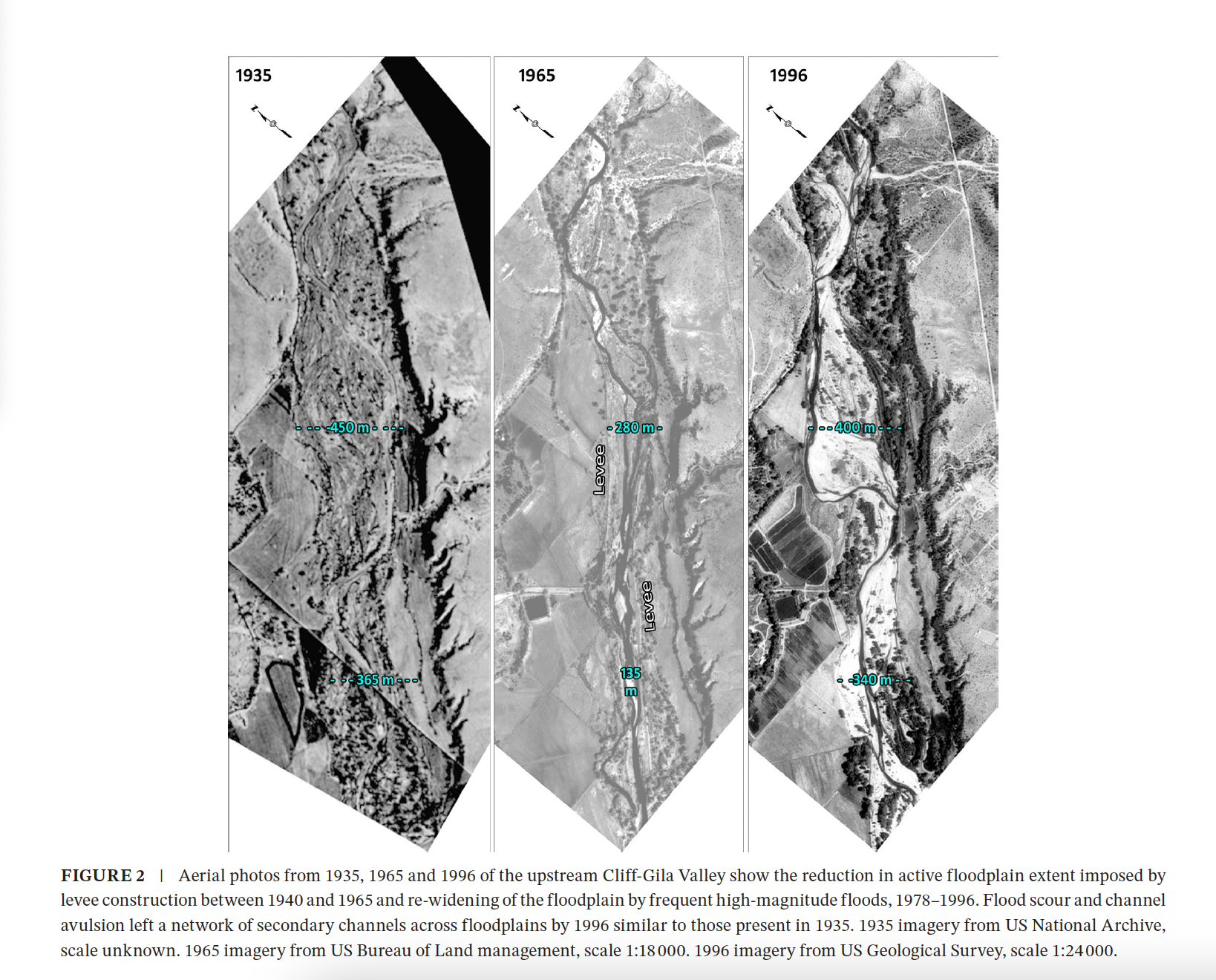
Even without human-directed restoration projects in the Cliff-Gila Valley, the river is recovering and reclaiming a floodplain that humans had previously “simplified.” By 1960, the river’s active floodplain in the Cliff-Gila Valley had been “confined to less than half of its historic width” and by 1980, native forest cover had been reduced to 40-50 percent of its expanse in the early 20th century.
“The Gila was channelized and leveed, even into the 1970s, and really squeezed down to ridiculously narrow margins,” Cooper says. “We want rivers to stay where we want them, right? But in the Gila, there were big floods and the river reminded people, ‘I need more space than this. I need this much space.’”
By 1984, people had stopped trying to reduce the channel and build up the levees, and in the late 1990s, domestic livestock were moved off most of the valley’s floodplain. By 2000, the active floodplain was almost as wide as before channelization.
According to the authors, long-term data from the valley shows how maintaining that heterogeneity helps rivers — and their human neighbors — be more resilient to droughts, floods, and fire. During recent floods, adjacent landowners “lost” less land than in the past. As people stopped bulldozing the channel and allowing livestock to graze it to gravel, cottonwood trees and other native vegetation took hold. Healthy riparian forests slow waters, Cooper says, reducing their erosive powers during extreme events.
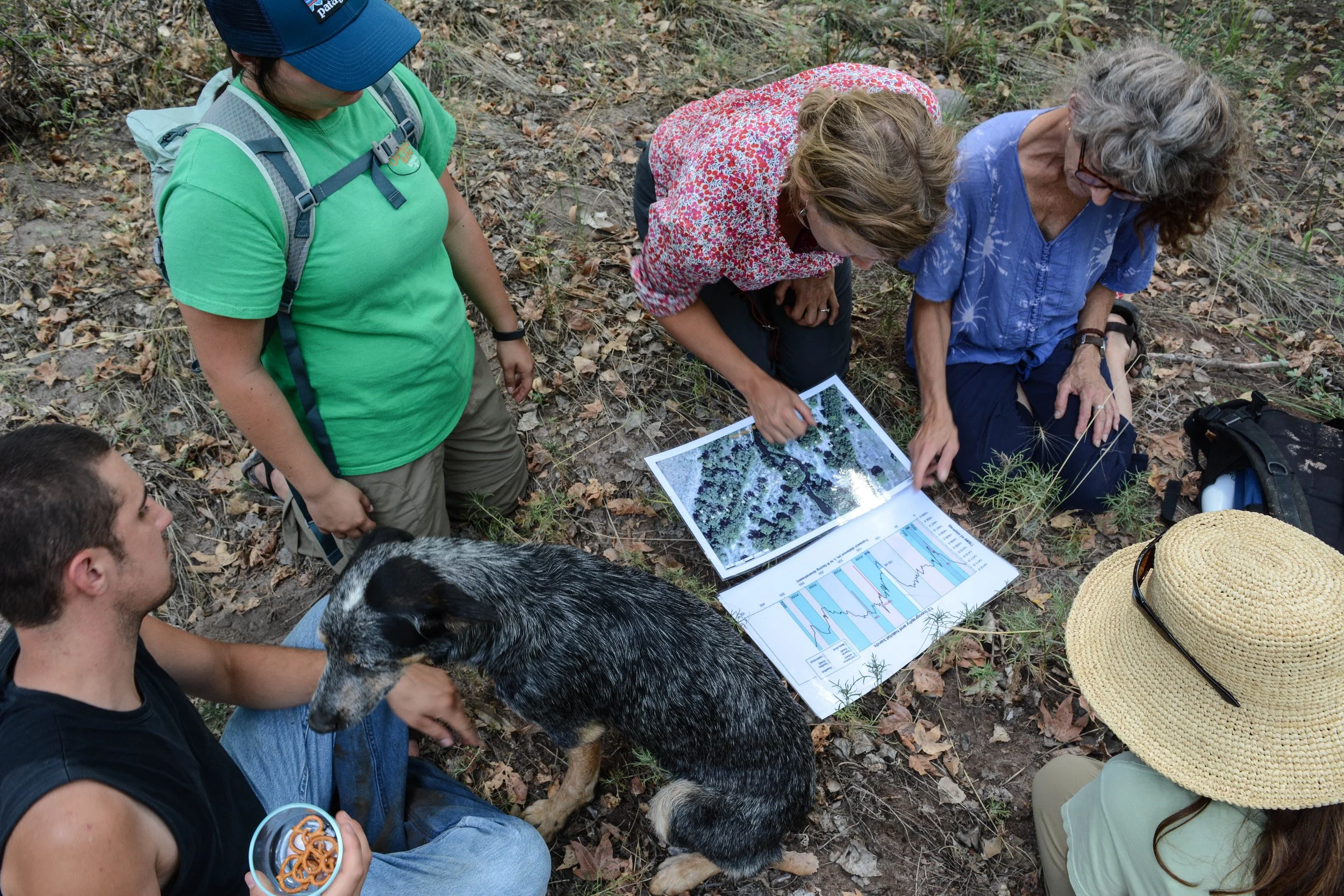
Martha Cooper and Ellen Soles with fellow surveyors (and a diligent pretzel watcher).
This image courtesy of Cooper, and the image above courtesy of Soles.
This stretch of the river has escaped damming and industrialization a handful of times, most recently in 2020, when New Mexico’s plans to build a diversion on the river fell through due to poor planning — and a fervent fight from environmentalists.
Today, however, more water is diverted for irrigation in the Cliff-Gila Valley than any time since before World War II. And once the river leaves the forest, irrigation diversions dry part of the river in May or June, sometimes into September or October — for longer stretches and longer periods of time. It’s hard for seeds to germinate and survive there, Cooper says, and “it’s a harbinger of the future if we don’t take care of our river.”
Cooper and Soles collected data for more than a decade, and also built on the work of others. The U.S. Geological Survey has operated a stream gage at the top of the Cliff-Gila Valley since the early 20th century. And other scientists have studied species, including endangered fish and birds, along the river for decades. “There’s value in long-term data sets,” she says. “We’re able to see the effect of these infrequent big floods, and we’re able to see the impacts of climate change and reduced flows.”
On the Gila, days of very low flow have already increased, including an unprecedented 21 continuous days of flows below 0.6 m3 s−1 (20 ft3 s−1) in 2013 (Horner and Dahm 2014). Future climate projections for the Gila River watershed suggest an increase in hydrologic extremes: higher annual temperatures and decreased precipitation during the spring and summer will depress both snowmelt runoff and summer low flows (Garfin et al. 2014; Gutzler 2013). In addition, the North American monsoon may intensify across the southwestern United States, which could result in more large floods during the late summer and autumn (Demaria et al. 2019; Luong et al. 2017).
The new study focused on a 30-kilometer stretch of the Gila River in New Mexico. But there are lessons for rivers across the Southwest, including a nudge to rethink management schemes that treat rivers like pipelines operated solely for human uses.
“If we could keep water in rivers, it could also be used downstream by other people. (Instead of) thinking in black and white, like, ‘Is there water for people or is there water for the river?’ we can think about managing rivers in a way where there are multiple benefits, and there's not a winner or a loser,” Cooper says. “It’s not farms or fish. It’s farms and fish.”
Rivers also need room to move, and space to stretch out during floods. Discouraging development in floodplains and allowing native riparian vegetation to thrive benefits river ecosystems and the species that depend on them — including humans and their nearby fields and homes. Conceding rivers the freedom to act like rivers would also help people appreciate their power, rather than being unnerved by it.
The Gila River is typically well-mannered, says Cooper. But when the waters roar in quick, steep floods — like in 2013 when September storms sent the Gila above 30,000 cubic feet per second — they create and destroy channels and swales, scouring out spaces for germination and future forests. “The big floods, they’re like the architects, and the mid-size floods, they keep things alive,” says Cooper. “I don’t think about the floods as angry. I think of them as powerful and beautiful.”
Please note that in an earlier version of the post, I misspelled Ellen’s last name. My apologies!